By Susan Hardee Steger
March 7, 2017 11:29 a.m.o
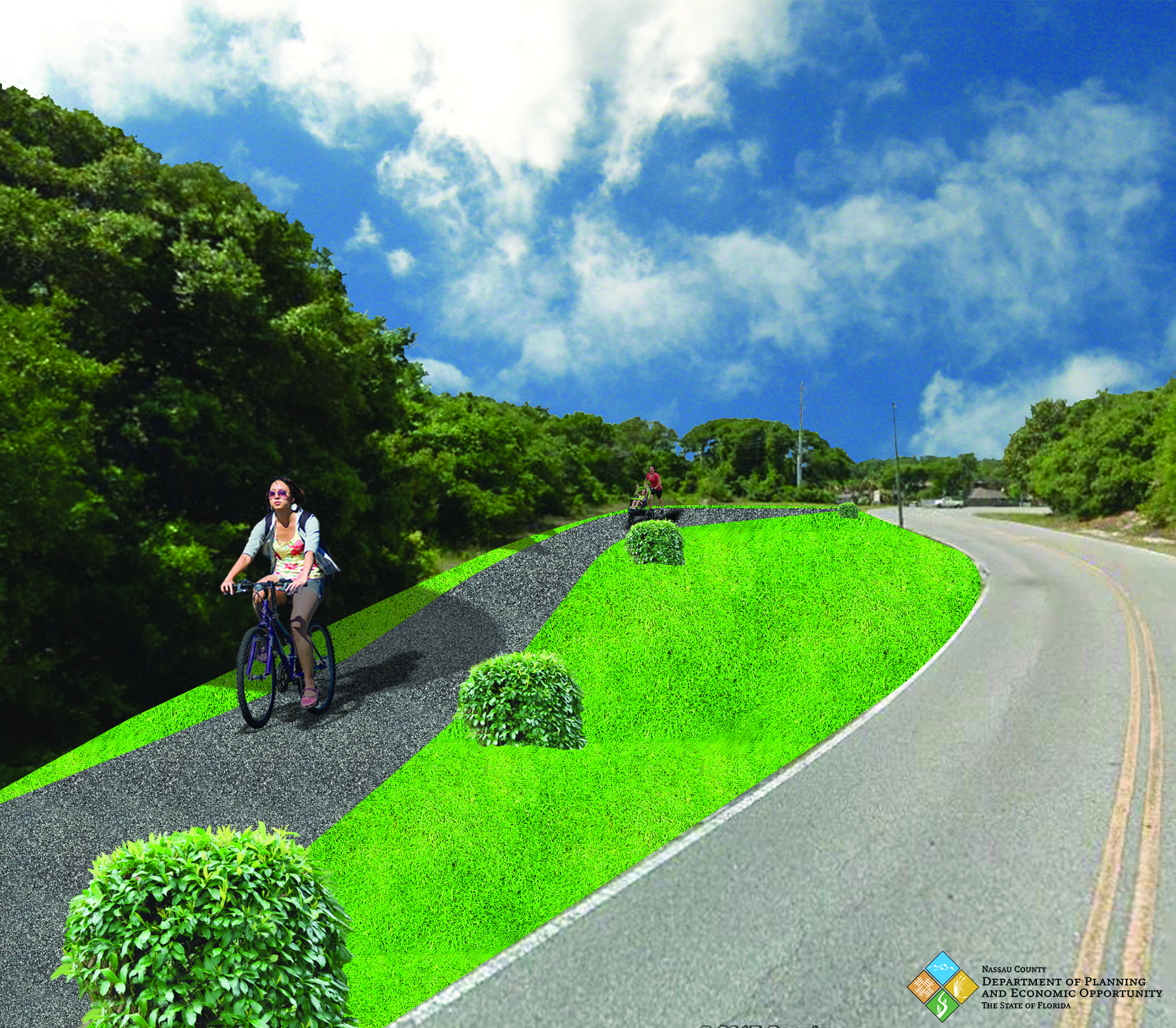
Friends of the Amelia Island Trail can place another feather in their caps with the acquisition of a 1.2 million dollar federal grant to fund the “River to Sea Trail.” Once completed, the addition to the Amelia Island Trail System will provide a safe bicycle and pedestrian route along well-traveled Simmons Road with connections to the Bailey Road Ybor Alvarez Ball Fields and Crane Island.
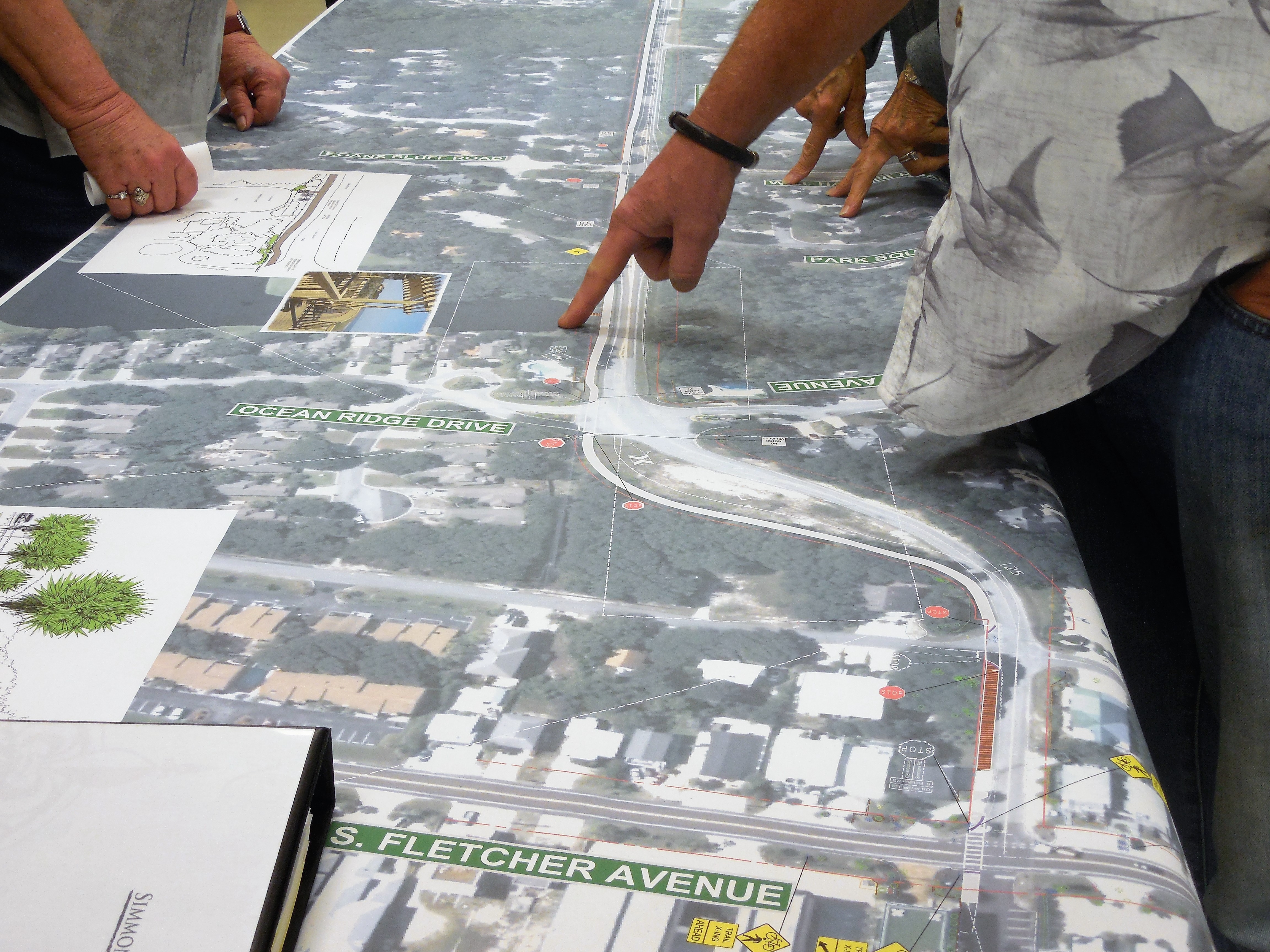
On Thursday, March 2, Nassau County and the City of Fernandina Beach staff members gathered together at an open house attended by approximately 100 area residents to answer questions, address concerns, provide information, and receive feedback from the public on the initial plans.
The “River to Sea Trail” will begin at the intersection of South Fletcher & Simmons Road and head west, and eventually turn toward the Ybor Alvarez Ball Fields located on Bailey Road. The developers of Crane Island have agreed to fund and continue the trail to Crane Island and construct an overlook near the Amelia River.
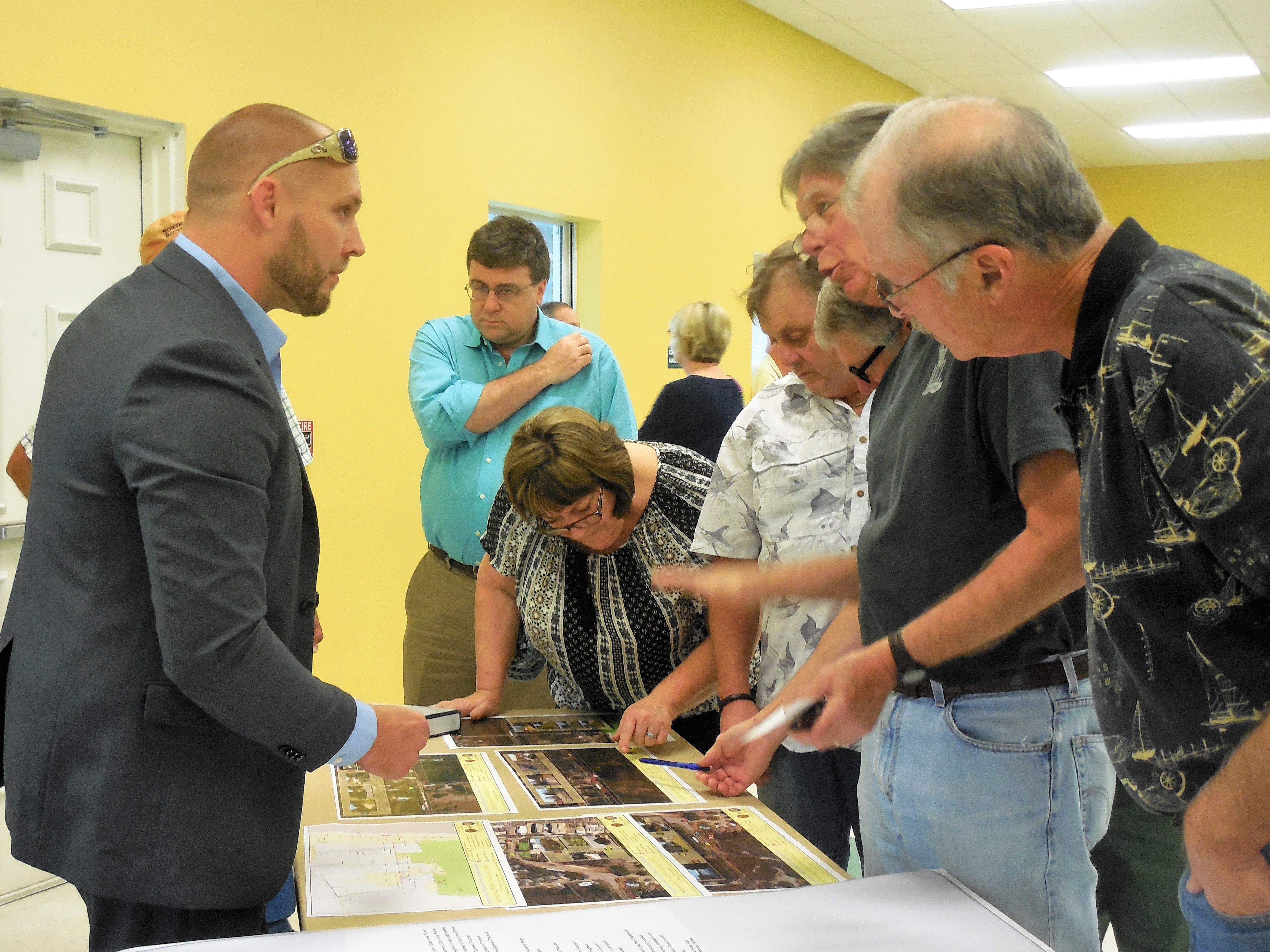
Mike Pikula, trail advocate and representative of Friends of the Amelia Island Trail, prepared the initial grant proposal managed and awarded by First Coast Transportation Planning Organization. The proposal included endorsements from nearby homeowner associations. No matching funds are required. Offering key support through the proposal and design phase were Nassau County’s Planning and Opportunity Director, Taco Pope and Senior Planner Kelly Gibson, from the City of Fernandina Beach.
It is possible the trail will be completed this summer, although design work is still ongoing. The planned width of the trail will be a minimum of 8 feet but will be wider in most locations. Pikula anticipates existing trail rules adopted by the Nassau County Board of Commissioners will apply. The rules allow use of the trail for pedestrians, bicyclists, electric ADA mobility devices that do not exceed 10 MPH, and prohibits golf carts and horses.
Scott Herring, Nassau County Public Works Director and his staff will oversee the federally funded project. According to Herring, since becoming Local Agency Program Certified in February of 2016, “This certification allows the county to manage and deliver projects that are primarily local in nature. Since local agencies are closest to the project, the process allows for delivery of a project that is more locally designed, while still meeting design requirements.”


This sounds good as long as the reps from affected subdivisions are involved.
This is wonderful & much needed as there already are many pedestrians & bicyclists using Simmons (at great peril). Congratulations & thanks to Mike Pikula for his hard work to make this trail a reality!!
It appears that the plans for the trail on the Simmons Right of Way, the area between Baily Road and Amelia Road, have changed from the original concept. Instead of sharing the already cleared path with FPU as the trail does on the south side of the island, the plans now call for destroying many large established trees by moving it over approximately 20 feet. Love the idea of the trail but why cut down trees on our beautiful island when there is already a clear path for paving the trail. This is not acceptable.
Yea Clara, lets save the trees by sharing the trail!
We, the residents of Spanish Way West and East in Isle de Mai will have the proposed bike trail in our back yards. We love the idea of a trail. We are shocked to see that the original route sharing the FPU access road has moved south, requiring the destruction of much established forest. Moreover, the new route will require some $30,000 of wooden bridge to drive over a portion of a pond. The solution is a simple one and also the original one and that is, build the bike trail ON the FPU access road. Let’s share this rarely-used space. We get to keep the forest and no bridge is necessary. County officials say they have not visited the site. We openly invite them and anyone else to do so. A short Powerpoint presentation illustrating the problem is available from [email protected]
This is in response to concerns about the planned Amelia River-to-Sea Trail expressed by Ms Mulder and others. I’m confident our City and County planners and the contract designer understand your tree conservation concerns and they will contact you to arrange discussions.
There are some aspects of the Trail as it relates to the area south of the Isle de Mai subdivision that I’d like to mention. First, please recognize that the utility company holds a necessary “utility easement” that permits access to maintain electric service. That easement constitutes a portion of the wider County right-of-way (ROW). Grant funding is limited, and I believe the budget for trail construction was based on a “light footprint” of recreational trail users, not for sustained use by heavy vehicles which utility companies must use to do their work. Accordingly, that is one reason why the trail was off-set to the most southerly side of the ROW, outside of the utility easement. To place it further north and fully within the utility easement would require it be built to sustain heavy vehicles without damage to the trail; such heavier duty construction may not be affordable.
Second, the general trail placement also accommodates requests from Isle de Mai residents to locate the trail within the ROW but as far to the south and away from private property lines as feasible.
Third, beyond conceptual 30% plans shown at the public meeting, my understanding is that the trail will “meander” for much of this segment to reduce the need to cut mature trees, and that the plan also calls for new plantings in appropriate areas to address residents’ privacy concerns and replace any trees lost. Trail users love trees and shade, too.
This east-west trail, a part of the Amelia Island Trail system, will provide safe, non-vehicular access between homes, our beaches, City ballfields and a riverside park using grant funding with no cost to County residents. I know the professional planners and designers will work with you to address your conservation issues.