Submitted by Suanne Z. Thamm
Reporter – News Analyst
November 8, 2018 12:48 p.m.
The City of Fernandina Beach contracted with the engineering firm Ayres Associates to provide structural inspection services and a structural assessment for select portions of the seawall at Fernandina Harbor Marina. The Fernandina Beach City Commission (FBCC) authorized this study because of concerns about the structural integrity of the seawall in light of what appeared to be hazards created by areas of sinking landside surfaces of marina property.

Ayres conducted the inspection during two days in August 2018. They concluded that the general condition of both the south breakwall (concrete) and the north breakwall (steel) is fair. The inspection did not reveal structural failure, although it did note safety concerns. The report stated that neither portion of the breakwall requires replacement at this time.
According to the report, the life expectancy of the seawall between the boatramp and Brett’s restaurant is estimated to be 5 years, if no repairs are made. However, if recommended repairs are made, that estimate increases to more than 20 years. Rick Maslyn, who both inspected the breakwall and presented the report to the FBCC at their November 7, 2018 Regular Meeting, estimated that the cost of the recommended repairs – excluding mobilization costs – would be $65,000. Repairing the steel breakwall north of Brett’s would involve also cleaning and coating the steel. Maslyn estimated that excluding mobilization costs, this action would cost $158,000 and would extend the life of that portion of the marina breakwall 12-15 years.

Repair work would be done from the waterside. In order to make the needed repairs, the boardwalks would need to be removed.
Ayres did not conduct excavations of the land behind the seawall and could not definitively cite a cause for the holes that frequently appear in grassy areas and the parking lots. However, they identified several potential causes for loss of fill for the concrete seawall construction. The following 4 paragraphs are taken from the Ayres Report:
The first potential source is weepholes, which are located throughout the concrete seawall to alleviate water pressure on the retaining wall. Modern weephole construction consists of a hole located in the wall with a mesh screen placed on the backside of the wall. A geotextile mesh and small rock surrounds the mesh screen to prevent soil exiting the weephole with the drainage water. No such detail was found on the 1962 plans.
The second potential source is the precast concrete wall joint. During initial construction, the groundline in front of the wall was located just above the horizontal concrete joint with a geotextile fabric placed on the backside of the joint to prevent fill loss. Groundline measurements were taken at 25 ft. intervals along the length of the pier show a consistent degradation (soil loss) that varies from 0.7 ft. at the concrete boat ramp to 1.7 ft. at the end of the timber boardwalk near the commercial building. Due to the degradation scour, the horizontal joint is exposed along the length of the wall (See Photo 5). Fill can seep through this construction joint if the joint is not perfectly flush and the geotextile was not placed correctly during initial construction.

The third potential source of fill loss is underneath the precast concrete wall. The concrete wall originally extended to 5.2 ft. below the groundline according to the 1962 plans. The concrete wall is 3.5 ft. below the current groundline due to the scour observed. If water pressure builds up behind the wall and the weepholes are not working properly, water and fill may seep out the below the wall. The bottom of the concrete wall was not found with hand probing during this inspection and no active fill loss was observed.
Another potential source is related to the backfill material used during the initial construction. Proper backfill (soil placed behind a retaining wall) installation is a comprehensive process that involves placing layers or lifts of properly graded structural fill which are then compacted prior to the placement of the subsequent lift. This process is repeated until the fill reaches the specified finished grade. From our discussion with locals, the backfill utilized during the initial construction consisted of broken concrete and other miscellaneous disposal materials, which were not properly compacted. Over many years, this type of backfill can undergo differential settlement and degrade thereby exhibiting random voids seen at the surface.

Maslyn did not attribute the existence of holes landside of the seawall to subsidence. Rather, particularly in the north area, he believed that the holes were probably related to the ballast blocks that were used to fill in the area as the northern seawall was being constructed.
When asked whether it would be more costly to repair or replace the seawall, Maslyn estimated that in material cost alone, replacement would be about four times the cost of repair.
Commission discussion

Commissioner Chip Ross pointed out all the unknowns remaining on the seawall question. He cited that without excavation, the true condition of the tiebacks could not be determined. He said that without more in-depth investigation there was no guarantee that the suggested repairs would stop the problem with holes developing landside of the wall.
Ross further noted that there is no way to increase the height of the existing wall to allow it to act as a flood barrier. He asked for estimates on costs to elevate the seawall and extend its length along the entire downtown shoreline.
Vice Mayor Len Kreger suggested that since the city already has grant money in hand that could be used to repair the seawall, that effort should move forward.

Commissioner Roy Smith commented, in light of Ross’ call for a higher seawall (possibly 15 feet), that aesthetics of such a move would have to be taken into consideration. “The people would not stand to have their view of the sunsets over the river blocked,” Smith said. “Otherwise, it’s going to look like the Berlin Wall over there.”
Maslyn seemed to support Smith’s assessment. “I’ve done a lot of work around the state,” Maslyn said. “And what you do has to be what the community wants. Louisiana did not want a huge wall, so they built levees, and the levees were breached. We don’t have a perfect answer for you.”
Smith suggested it might be worth studying the cost and benefits of building a smaller wall further eastward of the existing seawall to act as a flood barrier.
There was no discussion over the future of the boatramp if the seawall were to be replaced with a higher seawall/flood barrier.
Ross concluded, “The question before the city is do we want to spend whatever it takes to repair this wall, which could easily go much, much higher [than the material estimates provided by Ayres] because you don’t know what happens when you open up that wall or do we want to put in a new wall and raise it up for flood protection?” Ross asked commissioners and the city manager for opinions, adding that before a waterfront park is built, this problem needs resolution.

Kreger reminded commissioners that the city has $37,500 to do a resiliency study. “If the issue becomes is it sea level rise or storm surge, we should proceed with the study. We now know that the existing seawall is good for 5 years, so we have time to get all the information we need before taking action.”
Stormwater department head Andre Desilet said that once the city decides the level of protection it needs, it can proceed with additional study, which could be done in 3-4 months.
Public comment
Mac Morris reminded commissioners that he had presented a plan several years ago to build a second seawall west of the existing one and backfill between the two walls. Smith asked Morris if he was an engineer. Morris replied that he was not but had done a lot of building. Smith dismissed Morris’ plan based upon his experience over the years in dealing with the Corps of Engineers. “If you put one teaspoon of dirt into the water, the Corps will shut you down,” Smith said.

Allen Mills, a boat captain who also serves on the city’s Marina Advisory Board, addressed the FBCC. He reminded commissioners that the state had just experienced a major hurricane in the Panhandle. “You know, it doesn’t matter what you build, if the Good Lord is going to put it on us, you better find a place to drain it. Wasting money, blocking the sun … Let’s just get [the seawall repaired] and quit spending our money on studies about it. It needs repairing. There are holes that people are going to fall into. … Let’s repair these walls, get the marina operating. If we get a major storm, it doesn’t matter what we build. It’s going to be wiped out. Best thing to do is pray that we don’t get a major storm. The worst storm we’ve had has been Matthew that sent water as far as the Palace Saloon. And you know what? We survived. If you build a wall on the west side, you’ll have to build a wall on the east side. Before you know it we’ll be living in a prison – a concrete house.”
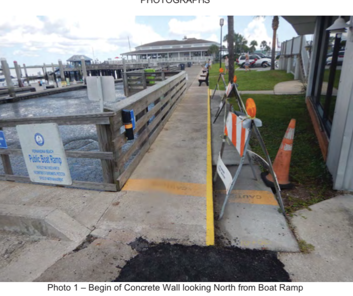
The entire Ayres report is available to the public on the city’s website.All photos of the existing seawall inspection were taken from this report.
 Editor’s Note: Suanne Z. Thamm is a native of Chautauqua County, NY, who moved to Fernandina Beach from Alexandria,VA, in 1994. As a long time city resident and city watcher, she provides interesting insight into the many issues that impact our city. We are grateful for Suanne’s many contributions to the Fernandina Observer.